


Researcher. Educator. GIS Specialist.
For nearly 20 years, Andrew has helped municipalities, public health agencies, non-profit organizations, educational institutions, and community partners use research, evaluation, and spatial analysis to better understand communities and make evidence-informed decisions.
Quick Facts
✅ 20+ Years of GIS & Research Experience
✅ 30+ Peer-Reviewed Publications
✅ 25+ Conference Presentations
✅ $500K+ Research Funding Supported
✅ Professor, Fanshawe College
✅ Founder, Healthy Way Consulting
Andrew’s Career Journey
Education, Research, & Employment
THE FOUNDATION
STUDENT TO SPECIALIST

Wilfrid Laurier University
Bachelor of Arts, Geography
2001 – 2005
Built a foundation in geography, mapping, and statistical analysis.

Sir Sandford Fleming College
GIS Application Specialist
2005-2006
Specialized in GIS, cartography, remote sensing, and spatial data.
Wilfrid Laurier University
Master of Arts, Geography
2006 – 2008
Began applied transportation and community-based research.
THE ACADEMIC ARC
RESEARCH & EDUCATOR

McMaster University
PhD, Geography
2008 – 2013
Advanced expertise in health geography, GIS, and quantitative research.

Western University
Post-Doctoral Fellow
2012 – 2016
Applied GIS and research methods to public health and community research.
LEADING IMPACT
RESEARCH, TEACHING, & CONSULTING

Human Environmental Analysis Laboratory
Senior Research Associate
2016 – 2022
Led community-based research, evaluation, policy, and GIS initiatives.

Fanshawe College
Professor
2020 – Present
Teaching GIS, planning, and environmental design to future professionals.

Healthy Way Consulting
Founder & Principal Consultant
2022 – Present
Helping organizations turn data into action and community impact.
Areas of Expertise
Research & Evaluation
Designing and evaluating programs, policies, and initiatives that improve community outcomes.
Research and evaluation experience includes:
- Program evaluation
- Community needs assessments
- Health promotion research
- Survey design and implementation
- Qualitative and quantitative analysis
- Performance measurement
- Knowledge translation
GIS & Spatial Analysis
Using maps and spatial data to understand accessibility, identify inequities, and support planning decisions.
GIS & Spatial Analysis experience Includes:
- Accessibility analysis
- Service area studies
- Health geography
- Transportation planning
- Community asset mapping
- Population and demographic analysis
- ArcGIS Online & Enterprise GIS
Community Impact
For more than 15 years, Andrew has collaborated with organizations across Southwestern Ontario to address issues related to

Public Health
Providing evidence to support healthier and more equitable communities.

Active Transportation
Creating safer and more accessible opportunities for active travel.

Children & Youth
Supporting initiatives that help children and youth thrive.

Parks & Recreation
Improving access to recreation, physical activity, and community spaces.

Road Safety
Using data and research to make transportation systems safer for all users.
Planning & Policy
Turning evidence into policies and plans that strengthen communities.
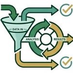
Program Evaluation
Helping organizations understand what works and demonstrate impact.

Training & Education
Sharing knowledge and skills to support learning and professional growth.
Sample Projects
Active School Travel
Policy Scan
Evidence-based recommendations supporting active transportation across Ontario.
Grade 5 ACT-i-Pass
Program Evaluation
Evaluating the impact and equity of a community-wide recreation initiative.
Healthcare
Accessibility
Using GIS and spatial analysis to improve understanding of healthcare access across Southwestern Ontario.